
Review · SICILY
Etna – Trekking to the summit craters (only guide service) experienced hikers
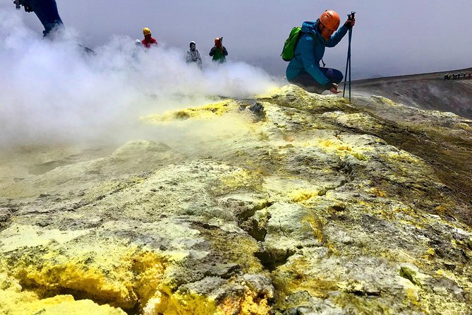
Etna’s north side gives you the most serious version of a summit outing. From quiet Piano Provenzana, a volcanologist leads you by 4×4 through lava fields, then on foot toward Etna’s upper craters at roughly 3,300 meters. The mountain may be smoking, steaming, or restricted, so the final route is decided on the day.
I like the small groups of up to 12 and the patient pace set by guides such as Poldo, Nikos, and Daniele. I also like that you get more than a summit photo: recent lava flows, old side craters, volcanic explanations, and wide views toward Sicily and the Aeolian Islands.
The main catch is the effort and the extra transport charge. This is not a gentle stroll, and the 7-kilometer descent can be harder than the climb. The 4×4 or return transport is also paid separately, so check the exact arrangement before you commit.
Key points to know before you book
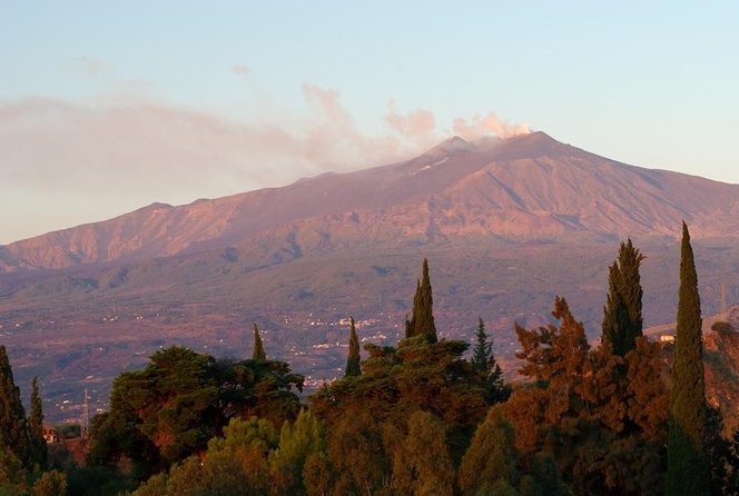
- You start on Etna’s quieter north side: Piano Provenzana feels less crowded than the southern station and sits among the lava flows of the 2002 eruption.
- You climb from about 2,960 meters: The high-altitude section reaches the summit area at roughly 3,323 meters when conditions allow.
- The route changes with the volcano: Gas, heat, unstable rock, weather, and official restrictions can shorten or redirect the hike.
- The descent is the real test: Expect soft scoria, sandy gullies, rough lava, and about 1,500 meters of downhill travel.
- Equipment is supplied: Trekking poles, shoes, a helmet, warm jacket, socks, and an extra backpack are listed as included.
- Budget for transport: The off-road vehicle charge is listed at €50 per person one way, with a higher €70 charge for the public bus return option.
Starting at Piano Provenzana after the 2002 eruption
Your meeting point is the Chiosco Bar Mareneve at Piano Provenzana, on Etna’s north side above Linguaglossa. The road to the area is paved and accessible by private or rental car. Parking costs €5 on weekdays and €8 on Sundays and public holidays.
Arrive for the 7:45 a.m. meeting time. The group normally leaves between 8:00 and 8:15. At the café, you can use the restroom, have coffee or tea with a pastry, and fill your water bottle before heading up. That small pause matters because there are no ordinary services once you leave the base area.
Piano Provenzana was destroyed by the October 27, 2002 eruption. The rebuilt tourist area is surrounded by pine forest, black lava, and broad volcanic slopes. It is also a ski station in winter, then shifts toward hiking and guided excursions in the warmer months.
I prefer this starting point to a crowded lift station. The north side feels more open and raw, with fewer buildings and less traffic. It also gives you a direct reminder that Etna is not a museum piece. The ground here was reshaped in recent volcanic time.
In winter, carry snow chains or use winter tires. The road may be paved, but mountain conditions can still make the drive difficult.
More Volcano Hikes in Italy
- Mount Etna: Summit Guided Hiking Tour up to 3,400 m
★ 4.8 · 4,792 reviews - Mount Etna: Trek to 3000m with cable car and 4×4
★ 4.6 · 3,823 reviews - Mount Etna: Summit Crater Trek with Cable Car
★ 4.8 · 1,875 reviews
The 9.5-kilometer 4×4 ride up Etna’s north slope
After a short safety briefing, you board an authorized 4×4 vehicle with your guide. The ride follows an unpaved track for about 9.5 kilometers, rising from roughly 1,800 meters to the high starting point near 2,960 meters.
This is not just a shuttle. The track crosses forests, fresh lava flows, eruptive fractures, side craters, and a lava-flow channel. Some lateral craters are more than 40 meters deep. The guide stays with the group during the drive and explains what you are seeing.
On clear days, the route opens to northern Sicily, Calabria, the Strait of Messina, the Aeolian Islands, and both the Ionian and Tyrrhenian Seas. You might also see the Madonie range, the Gulf of Catania, Syracuse, Augusta, and the enormous Valle del Bove. Visibility is never guaranteed, but the ride still gives you a useful sense of how Etna’s volcanic layers fit together.
The added transport cost needs careful attention. The tour price is listed as $139.13 per person, but the off-road vehicle from the lower station is not included. The supplied details list €50 per person for the one-way vehicle ride from 1,800 meters toward 2,825 meters. Those same details describe the hiking start near 2,960 meters, so I would confirm the exact current vehicle arrangement before booking.
Some information also refers to returning by bus from 2,850 meters for €70 instead of €50. That is important because the advertised price is not the complete cost of the day.
Climbing from 2,960 meters to Etna’s summit area
The walking section begins high on the mountain. The route climbs about 5 kilometers, with roughly 550 meters of ascent, toward the upper crater zone. The altitude ranges from about 2,960 to 3,323 meters.
You walk over soft black scoria, loose sand, steep gullies, and rough volcanic rock. The footing is not like a maintained hiking trail. Each step can slide slightly, especially on the way down. Trekking poles are useful, and the supplied poles help with balance on unstable ground.
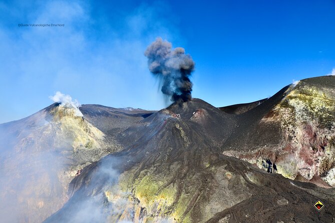
The guides aim for the safest route toward the most active crater that can be approached responsibly. Etna has four main summit craters: the North-East Crater, Voragine, Bocca Nuova, and the South-East Crater. You may see one or several, depending on activity, access rules, gas, heat, and the condition of the ground.
This flexibility is essential. A description promising a fixed point at 3,323 meters should not be read as a guarantee. The summit zone can close or change quickly. One recent account describes reaching only about 3,000 meters because of activity near the top. That is not a failure of the guide. On an active volcano, the safe stopping point can change by the hour.
The guides follow official orders and local safety limits. They may pass barriers that ordinary visitors cannot cross, but they remain responsible for deciding how far the group can go. If an eruption, gas release, storm, ice, or unstable ground makes the upper area unsafe, the hike will stop or follow another route.
That is also why the experience can be rewarding. You are not following a rigid sightseeing script. The guide is reading the mountain and adapting the day around real conditions.
What the volcanic terrain feels like underfoot
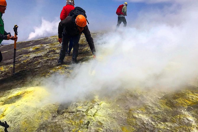
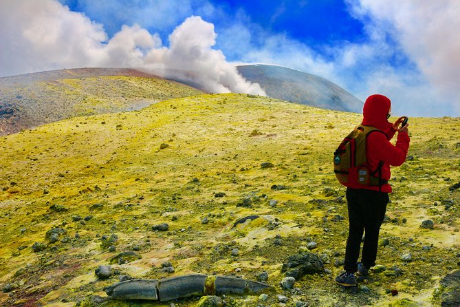
The upper section takes you from green woodland into a stark zone of ash, lava, and wind. The change is quick and striking. You leave the trees behind and move through a high volcanic desert where the ground is made of loose scoria and broken lava.
The path follows sandy gullies and recent lava before crossing the wide Piano delle Concalze. Along the way, the guide explains crater formation, lava flows, gas, eruptions, and the history of Etna’s activity. Guides such as Nikos, Daniele, Poldo, and Raphael have been singled out for clear explanations and an easy manner.
The crater edges can cause dizziness, especially when the wind is strong or the ground drops sharply. Volcanic gas is another concern. Do not use contact lenses if fumes and ash bother your eyes. You should also tell the guide about health conditions, particularly breathing problems or high blood pressure.
The mountain can feel cold even in a sunny forecast. Wind at 3,000 meters changes the day quickly. Pack gloves and a hat in autumn, winter, and spring, since those are specifically excluded from the supplied equipment. Sunscreen is sensible too. You can get sun, wind, cold, and volcanic dust in a single morning.
Same mountains, a different route up:
- Cinque Terre Day Trip with Optional Hiking or Pisa
★ 5.0 · 8,486 reviews - Florence: Cinque Terre Day Trip with Optional Hiking or Pisa
★ 4.9 · 4,848 reviews - Etna: summit craters trekking with volcano guide 3350mt
★ 4.7 · 1,712 reviews - Catania: Mount Etna Trekking Tour Beyond the Tourist Trails
★ 4.9 · 1,596 reviews
The long descent is harder than it looks
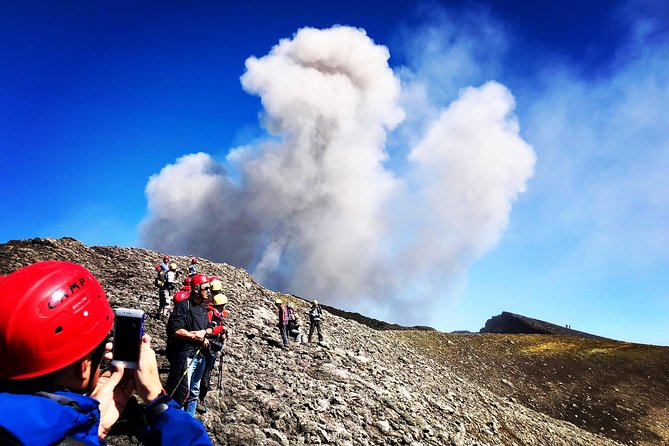
The official walking distance is about 12 to 13 kilometers in total, with an overall duration of about six hours. The return begins near 3,300 meters and drops to around 1,800 meters, with approximately 7 kilometers of descent and 1,500 meters of negative elevation.
This is the part I would not underestimate. Going uphill is tiring, but downhill walking on loose scoria can make your thighs and knees work harder. You may slide in the sandy sections, then move over rough, stony ground across about 2.5 kilometers of ski slopes.
Wear long pants and long socks. Small lava stones can enter your shoes during the descent and become surprisingly irritating. Sturdy boots are important, and the operator warns that you are not covered by insurance without suitable footwear.
The listed equipment includes trekking shoes, a warm jacket, extra socks, a helmet, trekking poles, and an extra backpack. Some booking information and past arrangements also refer to low-cost rentals for shoes or jackets. Confirm what is included in your specific booking, but do not rely on ordinary trainers for this route.
Pack lunch and plenty of water. Food at the café is available before the start, but the hike lasts long enough that you will want something to eat on the mountain. A simple sandwich can taste particularly good after the steepest part.
Guide quality and group size
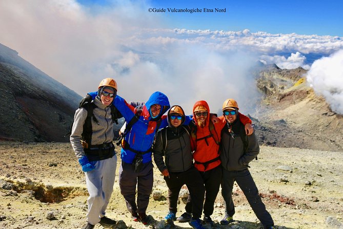
The tour is limited to 12 people. That is a useful size for an active volcano because the guide can keep the group together and adjust the pace. Small groups also make it easier to hear explanations and ask questions at crater stops.
The strongest part of the guiding is the mix of safety and geology. The guides do not simply point at a smoking crater. They explain why lava formed in a certain place, how recent eruptions changed the slope, and why the route may move away from the most obvious feature.
Poldo has been described as personable and attentive. Nikos is noted for pacing groups well and offering detailed explanations. Daniele has been praised for making technical subjects easy to understand and for reassuring people who feel nervous near the crater edges. Names and guide assignments can change, but the guiding style is a central part of the outing.
The pace is designed to keep the group together. That does not make the route easy. You still need good general fitness, strong legs, and comfort walking on unstable ground at altitude.
The excursion is not suitable for children under 12. Pregnant women beyond the third month cannot take part. Anyone with a serious breathing condition, high blood pressure, or another relevant health issue should discuss it with the guide before departure.
Price, timing, and what the day really costs
The advertised price is $139.13 per person. For a licensed volcano guide, group insurance, equipment, access to Mount Etna, a high 4×4 approach, and several hours of guided walking, that can be fair value.
The price needs to be read carefully. Transport from your accommodation is not included. The off-road vehicle charge is separate, and the listed amount is €50 per person one way. The alternative public transportation option from about 2,850 meters is listed at €70 instead of €50. Parking is extra as well.
The morning schedule is the better choice if you want cooler conditions and a longer day on the mountain. An afternoon departure at 1:00 p.m. is available from May through October, but the supplied schedule describes the main meeting time as 7:45 a.m. Confirm the departure time at booking.
Although the tour summary says about five and a half hours, the full outing can take closer to six hours or more. The route, weather, group pace, vehicle arrangements, and volcanic restrictions all affect the finish time. Keep the rest of your day flexible.
You can cancel for a full refund up to 24 hours before the start. If poor weather or an insufficient group causes cancellation, you should be offered another date or a full refund. Last-minute changes are not accepted inside the 24-hour window.
Safety matters more than reaching a number
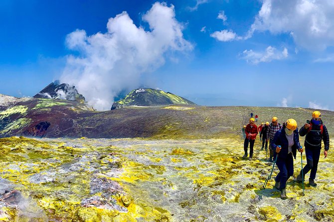
A summit tour on Etna is never a promise that you will stand at one exact altitude. The volcano remains active, and its gas, heat, fractures, and eruptions can change the rules.
The guide may shorten the hike, stop below the summit, or cancel the outing if conditions become unsafe. That can be disappointing, especially when the tour is marketed around the summit craters, but it is the correct trade-off. A safe view from 3,000 meters is better than a risky attempt at 3,323.
Bring warm layers, gloves, a hat, sunscreen, water, lunch, long pants, and sturdy shoes. Use the supplied helmet and trekking poles. Keep your eyes open for loose rock and listen closely to the guide near crater edges.
Should you book the Etna summit crater hike?
Book this if you want the most demanding and informative version of an Etna visit. You will get a quieter north-side setting, a high 4×4 approach, a serious walk over volcanic ground, and a guide who can explain the mountain as conditions change.
Skip it if you want a short viewpoint stop, dislike loose downhill walking, or need a guaranteed summit arrival. The route is strenuous, the weather can turn, and the extra vehicle charge affects the final budget.
For a fit hiker who respects the volcano, this is a memorable day. The best reason to go is not simply the altitude. It is the chance to cross Etna’s recent lava, walk among summit craters, and understand why this mountain must be treated as an active force rather than a standard sightseeing stop.
FAQ
Where does the Etna summit hike begin?
The meeting point is Chiosco Bar Mareneve di Ferraro at Piano Provenzana on Etna’s north side, Via Provenzana, 95015 Linguaglossa, Sicily.
What time should I arrive?
The stated meeting time is 7:45 a.m. The group generally departs between 8:00 and 8:15 a.m. An afternoon departure at 1:00 p.m. is available from May through October.
How high does the hike go?
The walking route begins near 2,960 meters and can reach the summit area at about 3,323 meters when volcanic and weather conditions allow.
Is the 4×4 vehicle included?
The tour information lists the off-road vehicle charge separately. The stated cost is €50 per person one way from about 1,800 meters toward the upper station. Confirm the exact current arrangement before departure.
What equipment is provided?
The listed equipment includes a licensed volcano guide, trekking poles, trekking shoes, helmets, a warm jacket, extra socks, and an extra backpack. Hats and gloves are not included in autumn, winter, and spring.
How difficult is the hike?
You need strong physical fitness. The route covers about 12 to 13 kilometers, includes a 550-meter ascent, and returns with about 1,500 meters of downhill travel. The loose volcanic ground and long descent can be particularly demanding.
Can the route stop below the summit?
Yes. The guide can change or interrupt the hike because of volcanic activity, gas, heat, weather, unstable ground, official restrictions, or other safety concerns. A different stopping point does not guarantee access to the summit craters.
Recently reviewed hikes in Italy
- Amalfi Coast Path of the Gods Hike from Agerola★ 5.0 · 58 reviews
- Adrenaline River Trekking in Brembana Valley★ 5.0 · 13 reviews
- Agerola: Path of the Gods Guided Hiking Tour★ 4.7 · 48 reviews
- Catania: Mount Etna Sunset Trekking with Wine Tasting★ 5.0 · 140 reviews
- Stromboli: sunset trekking to Sciara del Fuoco – Ashàra★ 4.5 · 270 reviews
- Hike The Path Of Gods from Sorrento★ 5.0 · 208 reviews
- Path of the Gods Hiking Day Tour from Sorrento★ 5.0 · 110 reviews
- Private Cinque Terre Trek & Tour★ 5.0 · 122 reviews
Volcano Hikes, compared.
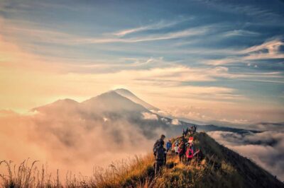
Bali: Sunrise Mount Batur Guided Hike with Breakfast
Read our review →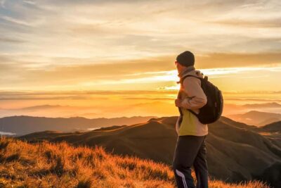
Bali: Mount Batur Sunrise Guided Hike and Natural Hot Spring
Read our review →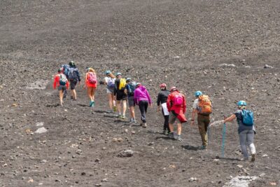
Mount Etna: Summit Guided Hiking Tour up to 3,400 m
Read our review →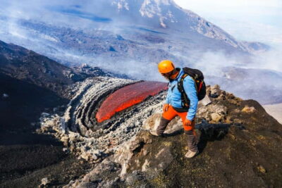
Mount Etna: Trek to 3000m with cable car and 4×4
Read our review →
Bali: Mount Batur Sunrise Trek With Guide and Breakfast
Read our review →
Mount Batur Sunrise Hike and Natural Hot Spring Option
Read our review →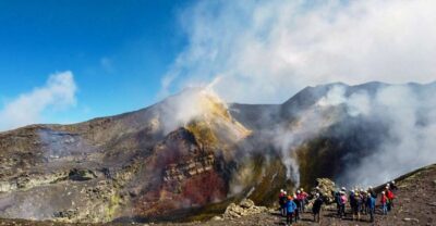
Mount Etna: Summit Crater Trek with Cable Car
Read our review →
Other lists this hike appears in