
Review · MONTERREY
Private Hiking to La M in Chipinque Ecological Park
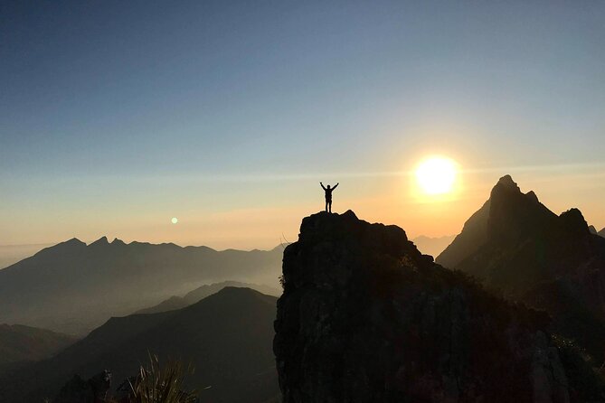
La M is not a gentle stroll with a viewpoint at the end. This is a private mountain hike that begins in cool forest, then turns into a steep, hands-on climb with cables, rock sections, and a final push to the summit cross. The reward is a full sweep of Monterrey, the Sierra Madre Oriental, and the surrounding forest.
I like the one-to-one attention and the way the guides adjust the pace. Guides such as JP, Uriel, Ana Pau, and Damian have helped people keep going when the climb felt harder than expected. I also like the practical extras: a mountain helmet, accident insurance, photos and videos from the day, snacks, soft drinks, and alcoholic drinks after the hike.
The main caution is fitness. Although the route is only about four miles round trip, the steep sections make it a serious workout, not a casual park walk. Start early if possible, since the heat can add a lot to the effort.
Key things to know before hiking La M
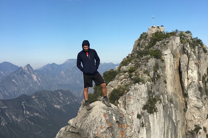
- The summit climb uses cables and steel rungs: These sections add adventure and support, but you need steady footing and comfort with steep terrain.
- The route takes about six hours and 30 minutes: Much of that time includes the ascent, summit stop, return, and time for photos and refreshments.
- A private guide makes a real difference: Your guide can set the pace, encourage you through difficult sections, and explain how to handle the route.
- The best views come near the top: You get forest scenery on the way up, then wide views of Monterrey and the mountain range from the summit.
- Wildlife sightings are possible but never guaranteed: Bears, deer, wild boars, coatis, and colorful birds live in the area.
- Transportation needs checking: The meeting point is at Chipinque Ecological Park, and private transportation is not included in the tour price.
Why La M is one of Monterrey’s great day hikes
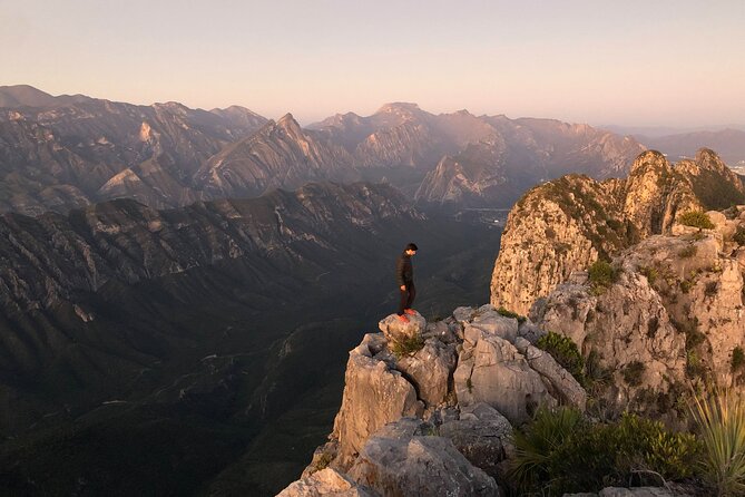
Monterrey is ringed by dramatic mountains, and La M gives you a direct way to experience them on foot. The hike begins at Chipinque Ecological Park, in the Sierra Madre zone above San Pedro Garza García, and climbs through forest toward a summit marked by a cross.
The route earns its name from the mountain shape associated with La M. You do not simply walk to a lookout, take a photo, and leave. The climb changes character as you go. The lower portion is a pleasant forest walk, while the upper section asks for stronger legs, careful balance, and a bit of nerve.
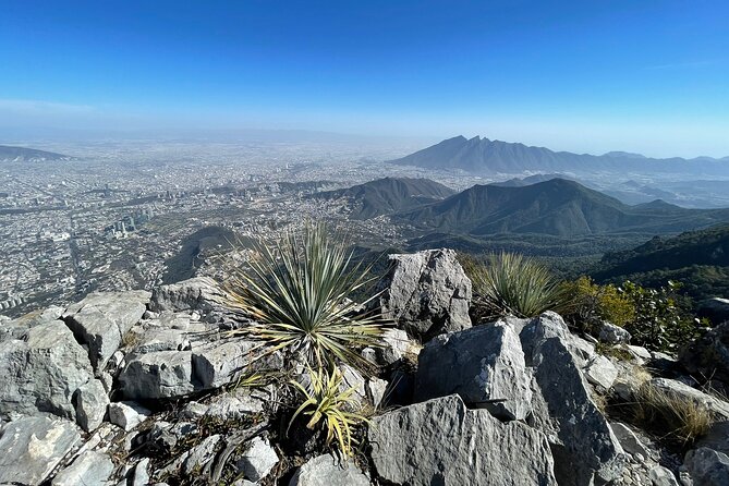
I especially like the contrast between the quiet trail and the city views. You can spend part of the morning under trees, then reach a point where Monterrey opens below you and the mountain ridges stretch across the horizon.
The tour is private, so only your group takes part. That matters here. A guide can slow down for one person, keep another moving, or pause for photos without trying to manage a large mixed group.
More Private Hiking Tours in Mexico:
- Fushimi Inari Hidden Hiking Tour (Private Option Available)
★ 5.0 · 1,750 reviews - Mount Batur Sunrise Trekking Private All Inclusive
★ 5.0 · 906 reviews - Mount Batur Sunrise Trekking Private Tour with Breakfast and Hotel Transfer
★ 5.0 · 885 reviews
Starting at Chipinque and settling into the forest
The official meeting point is Chipinque A.B.P. Ecological Park, at Carretera a Chipinque Km. 2.5 in Valle de San Angel, San Pedro Garza García. The activity ends at the same meeting point.
Pickup is offered in the tour information, but private transportation is also listed as not included. I would confirm the exact arrangement before booking rather than assume a hotel transfer is part of the price. If you are meeting at the park, the company says the guide will contact you at the agreed meeting point, and the vehicle should display the name The Outlands Adventures.
Once the hike begins, the early part is the most forgiving. The trail moves through forest, giving you time to warm up before the steeper work starts. This section is also a good chance to ask your guide about the route, set a comfortable pace, and look for birds or other wildlife.
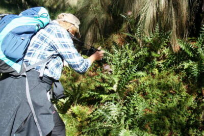
The area is known for bears, deer, wild boars, coatis, and many birds. Treat any sighting as luck, not as part of the guaranteed program. The main experience is the mountain itself, and wildlife may or may not appear.
The forest trail and the gradual climb
The lower route is described as a pleasant ascent through pure forest. That does not mean it is effortless, but the grade is more manageable than the upper climb. You can focus on your breathing, the changing views between the trees, and the feel of the trail beneath your feet.
This is where the private format begins to pay off. Guides including JP, Uriel, Ana Pau, and Damian have been praised for patience, encouragement, and adjusting to individual pace. Your assigned guide may be someone else, but the company uses a hands-on guiding style rather than simply pointing out the trailhead and walking ahead.
You should expect a steady workout. The route is short in distance, yet the inclines stretch the effort. One useful way to think about the hike is that it is more about elevation and steepness than mileage.
An early start is a smart choice. One account described the sunrise and cooler conditions as worth the early alarm, and avoiding the strongest heat can make the climb much more comfortable. The exact start time should be confirmed when you book.
The chorreadero and the hands-on sections
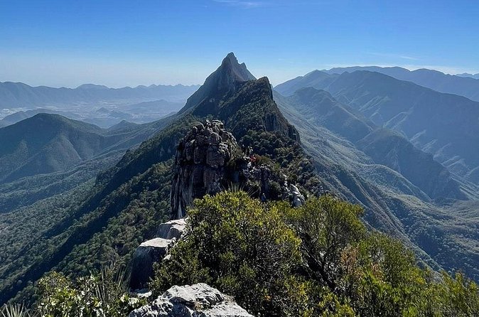
The most demanding part begins around the chorreadero and continues toward the summit. Here, the route becomes steeper and more adventurous. Steel cables provide something to hold, and the upper portion includes rock sections that require you to use your hands as well as your feet.
This is not presented as a technical climbing expedition, but it is more intense than a standard city hike. You need reasonable cardio fitness, secure footing, and comfort with steep ground. Recent knee, ankle, or back injuries are a strong reason to choose another activity.
The cables are useful because they give you support on the inclines. The route description also notes that these sections are not exposed to cliff drop-offs, which may reassure you if the thought of heights is your main concern. Still, steep terrain can feel demanding even without a sheer drop, so do not underestimate it.
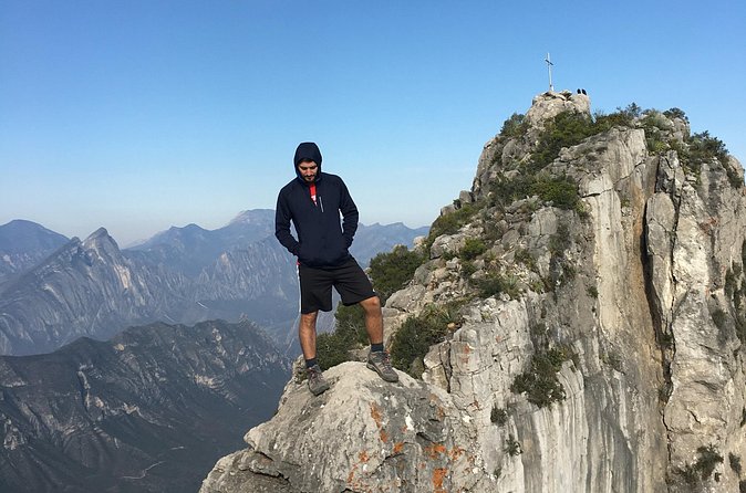
Near the top, steel rungs help with the final section. The summit cross is only a short distance beyond this point, but that last push can feel significant after the climb below.
Your helmet is included. It is a sensible piece of safety equipment for a route with rock and steep sections, though it does not replace careful movement. Let the guide set the safest pace for your group.
More hikes and treks around Mexico:
- Matacanes : Canyoning + Hiking + Water Jumps + Rappel + Caves
★ 5.0 · 1,497 reviews - Nido de los Aguiluchos, Monterrey: Hiking + Rock Climbing + 3 Rappels
★ 5.0 · 713 reviews - Puerto Vallarta: Full Day Hike to 6 Hidden Beaches & Snorkel
★ 4.8 · 403 reviews - Los Cabos: Hiking at the Fox Canyon with Waterfall
★ 5.0 · 369 reviews
Reaching the summit cross and the big payoff
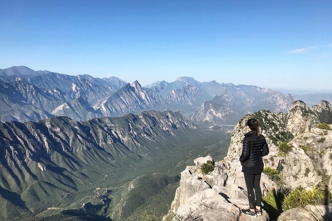
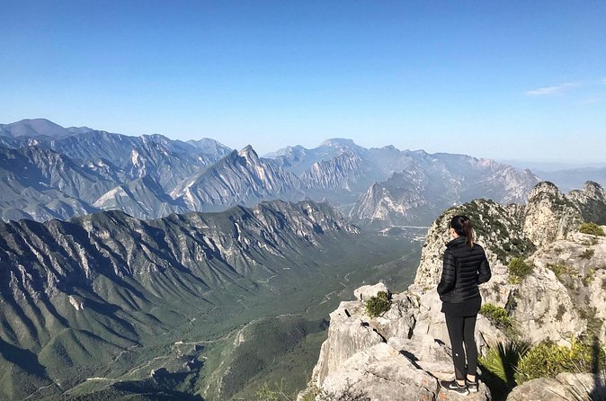
The views improve as you climb, but the major reward comes close to the summit. From the upper route, you can look across the Sierra Madre Oriental and down toward Monterrey. At the summit cross, the view becomes the kind that makes the earlier effort easier to understand.
You get more than one angle here. The summit offers broad views in several directions, while lower viewpoints show the mountain range from a slightly different position. Allow time for photos rather than rushing straight back down.
The photo service is a useful extra. The company says it will share all photos taken during the tour, and one participant also received videos. If you want to remember the day without stopping constantly to handle your own phone, this adds real value.
The summit is also the point where your fitness level becomes clear. Several people needed encouragement to finish, and guides such as JP and Uriel were described as motivating without abandoning the person’s pace. That support can turn a doubtful final stretch into a satisfying finish.
What the six-and-a-half-hour schedule really means
The advertised duration is about six hours and 30 minutes. The exact pace will depend on your group, the time spent taking photos, and how long you pause at the summit.
Do not interpret the duration as six and a half hours of nonstop climbing. The day includes the forest approach, the harder upper sections, time at the top, the return route, and the refreshments afterward. Even so, you should reserve most of the day and avoid scheduling an important appointment immediately after the activity.
The hike is described as about four miles round trip, but that distance can be misleading. Steep inclines and the cable sections make it feel much harder than a flat four-mile walk.
This is a good activity for someone who exercises regularly and wants a demanding outdoor experience. It is less suitable if you are looking for an easy introduction to Monterrey’s parks, a relaxed nature walk, or a family outing with young children.
Children under 12 are not recommended for this experience. The tour can be adapted for a person with a disability if you notify the company in advance and the route conditions make it possible. Ask before booking, since the summit section has steep and hands-on portions.
Drinks, snacks, and the end of the day
After the hike, the group can relax with snacks, soft drinks, and alcoholic beverages. This is a small but welcome touch after a demanding ascent and descent. It also gives you time to talk with the guide and enjoy the sense of having finished something substantial.
The food and drinks do not turn the tour into a meal, so plan accordingly. The key value is the guided mountain experience, not the refreshments. Still, having something ready at the end saves you from immediately searching for a shop or restaurant while tired.
Adventure accident insurance is included, along with the helmet. These inclusions do not remove the need for sensible preparation, but they make the package feel more complete than a basic guide-only hike.
Wear clothing suited to active walking and shoes with reliable traction. The supplied information does not specify a required shoe type, but the steep cables, rock sections, and rungs make ordinary smooth-soled footwear a poor choice.
Is $143.37 a fair price?
At $143.37 per person, this is not the cheapest way to see Chipinque. The value depends on what you want from the day.
If you only need access to the park and a trail map, the price will feel high. You are paying for a private English-language guide, route support on the difficult sections, a helmet, accident insurance, photos, snacks, soft drinks, and alcoholic beverages.
The private setup is the strongest part of the value. You are not tied to the pace of a large group, and the guide can give direct help on the steep portions. For a first ascent of La M, that may be worth more than saving money on a self-guided outing.
Group discounts are available, which can improve the cost for friends or family traveling together. The tour is often booked around 19 days ahead, so I would not leave it until the last minute if your Monterrey schedule is fixed.
The weather policy also matters. The activity requires good weather. If poor conditions cause cancellation, you are offered another date or a full refund. For a mountain route with steep rock and cable sections, that is a sensible policy rather than an inconvenience.
Who should book this hike?
I would choose this tour if you want a real physical challenge close to Monterrey, prefer a private guide, and care more about mountain views than a relaxed sightseeing schedule.
It suits you particularly well if:
- You have a moderate or better fitness level.
- You are comfortable with steep uphill walking.
- You want help on cables and upper rock sections.
- You would value photos and videos without taking every picture yourself.
- You want an English-language guide.
- You are traveling with a small private group.
- You want a sunrise or early start to reduce the heat.
I would think twice if you have a recent knee, ankle, or back injury, dislike steep ground, or want an easy nature outing. The route is safe when handled carefully, but safe does not mean easy.
The guides’ encouragement is a repeated strength of the experience. Ana Pau helped one participant keep going at a personal pace, while Damian was praised for accommodating the group. JP and Uriel were also singled out for motivation during the hardest parts. You should still arrive ready to work. A guide can support your effort, but cannot remove the climb.
Booking, cancellation, and practical details
Confirmation is received at booking, and mobile tickets are available. The tour is offered in English and is near public transportation, though the exact transit plan to Chipinque should be checked before you go.
Free cancellation is available if you cancel at least 24 hours before the start time. Changes or cancellations inside that window are not accepted for a refund. Cutoff times follow local Monterrey time.
Because pickup and private transportation are described differently in the information, ask exactly where you will be collected and whether any vehicle service carries an extra charge. The stated meeting point remains Chipinque Ecological Park.
Plan to spend the full six hours and 30 minutes on the activity. Keep your pace steady, listen to your guide on the cables and rungs, and save energy for the return trip. Descending can be hard on tired legs, even after the summit photos are done.
Should you book Private Hiking to La M?
Book it if you want Monterrey’s mountain setting in a serious, personal way. The summit views, private guidance, safety equipment, and patient encouragement make this a strong choice for an active visitor who wants more than a viewpoint reached by car.
Skip it if you want a gentle walk or if steep climbing is not a good match for your body. For everyone else, La M offers a clear payoff: a demanding route through forest, a hands-on final climb, and broad views that make the effort feel worthwhile.
FAQ
Where does the La M hike start?
The hike starts at Chipinque A.B.P. Ecological Park, Carretera a Chipinque Km. 2.5, Valle de San Angel, San Pedro Garza García, Nuevo León, Mexico.
Where does the activity end?
The hike ends back at the meeting point in Chipinque Ecological Park.
How long does the tour last?
The activity lasts approximately six hours and 30 minutes.
How far is the hike?
The route is described as about four miles round trip.
Is this a private tour?
Yes. Only your group participates in the activity.
Is the tour offered in English?
Yes. The tour is offered in English.
Is transportation included?
Private transportation is listed as not included. Pickup is also offered in the tour information, so you should confirm the exact pickup arrangement before booking.
What safety equipment is provided?
A mountain helmet and adventure accident insurance are included.
Is the hike suitable for children?
The activity is not recommended for children under 12 years old.
What happens if bad weather cancels the tour?
You can choose a different date or receive a full refund if the activity is canceled because of poor weather.
Recently reviewed hikes in Mexico
- Hidden Waterfalls Hiking Adventure★ 5.0 · 148 reviews
- Hiking Jorullo Point★ 5.0 · 138 reviews
- 4-Hour Jungle Hike and Waterfall Swim★ 5.0 · 197 reviews
- Puerto Vallarta: 4-Hour Jungle Hike and Waterfall Swim★ 4.8 · 163 reviews
- Trekking Through The Volcanoes★ 5.0 · 96 reviews
- Hiking Climbing And Rappelling In The Eaglets Nest★ 5.0 · 31 reviews
- From Mexico City: Hike Iztaccihuatl Volcano with an Alpinist★ 4.3 · 155 reviews
- Mexico City: Guided Volcano Trek with Lunch★ 4.7 · 242 reviews
Mexico Hiking Tours, compared.
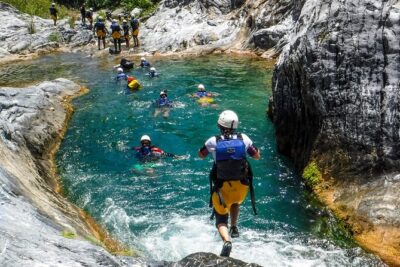
Matacanes : Canyoning + Hiking + Water Jumps + Rappel + Caves
Read our review →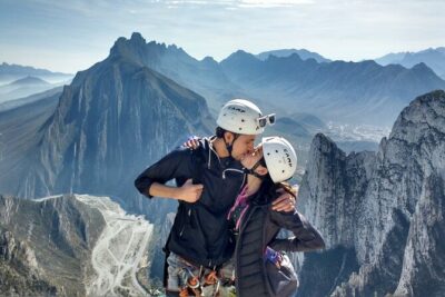
Nido de los Aguiluchos, Monterrey: Hiking + Rock Climbing + 3 Rappels
Read our review →
Puerto Vallarta: Full Day Hike to 6 Hidden Beaches & Snorkel
Read our review →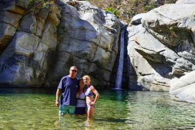
Los Cabos: Hiking at the Fox Canyon with Waterfall
Read our review →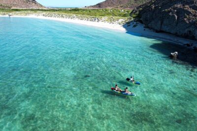
Balandra & Tecolote: hike, kayak and snorkel in paradise
Read our review →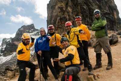
Other lists this hike appears in